FAQs
What is an RTK GPS system?
RTK stands for Real-Time Kinematic. An RTK GPS system is a high-precision positioning technology that utilizes a network of base stations and a mobile receiver to provide accurate real-time positioning information. It is commonly used in applications such as surveying, construction, agriculture, and mapping.
What is the difference between GPS and RTK?
GPS, or Global Positioning System, is a satellite-based navigation system that provides positioning and timing information globally. On the other hand, RTK, or Real-Time Kinematic, is a technique that enhances GPS accuracy by utilizing correction data from a nearby base control station. While GPS can offer meter-level accuracy, RTK provides centimeter-level precision, making it ideal for applications that require high precision, such as surveying and construction.
What is the best RTK GPS system?
Choosing the best RTK GPS system depends on your specific requirements and industry needs. The Hawk Vision RTK GPS System is widely regarded as one of the top options available. With its advanced technology, precise positioning capabilities, and seamless integration with excavator sensors, it offers exceptional performance for various applications.
How does the Hawk RTK GPS system work?
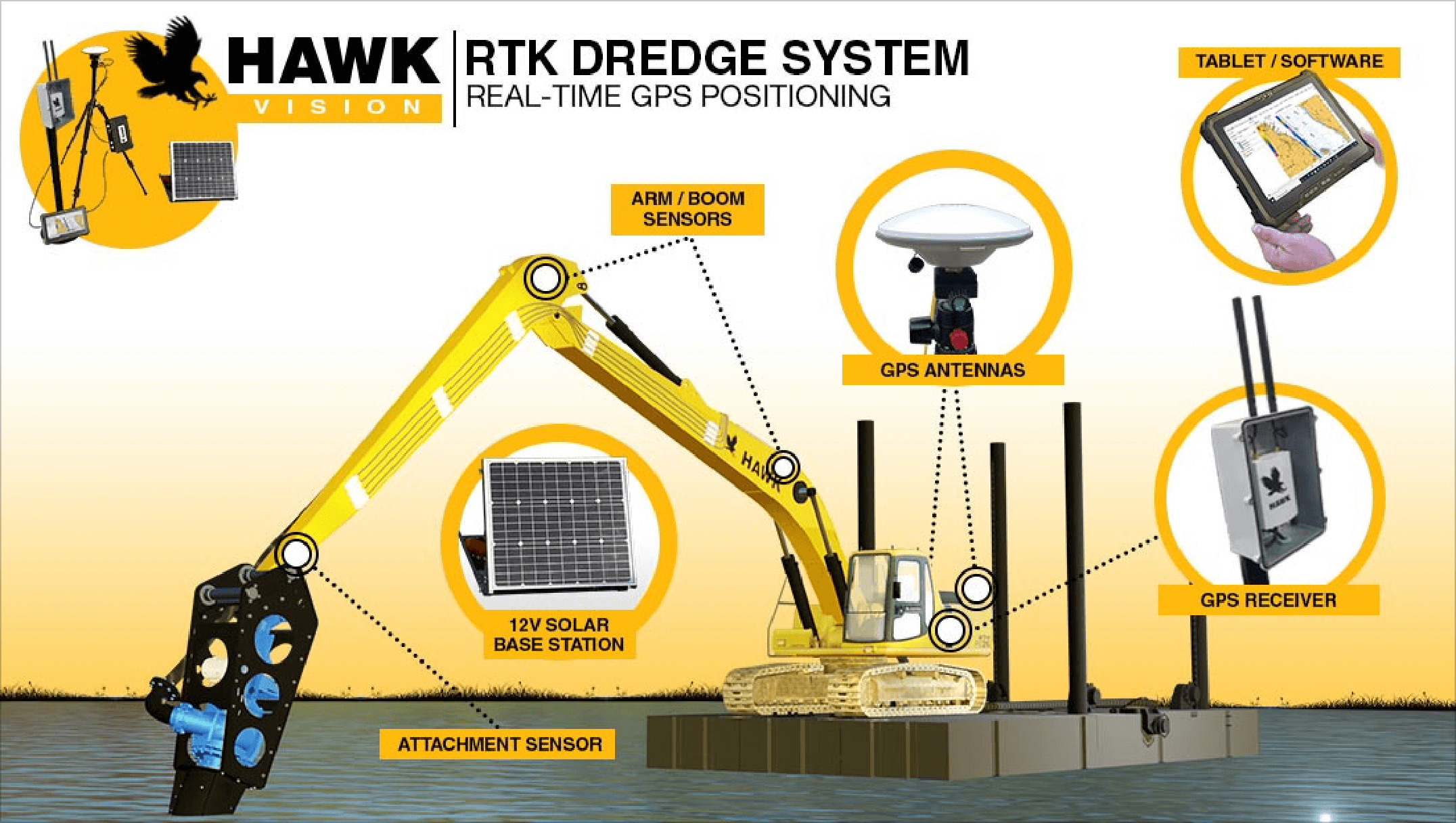
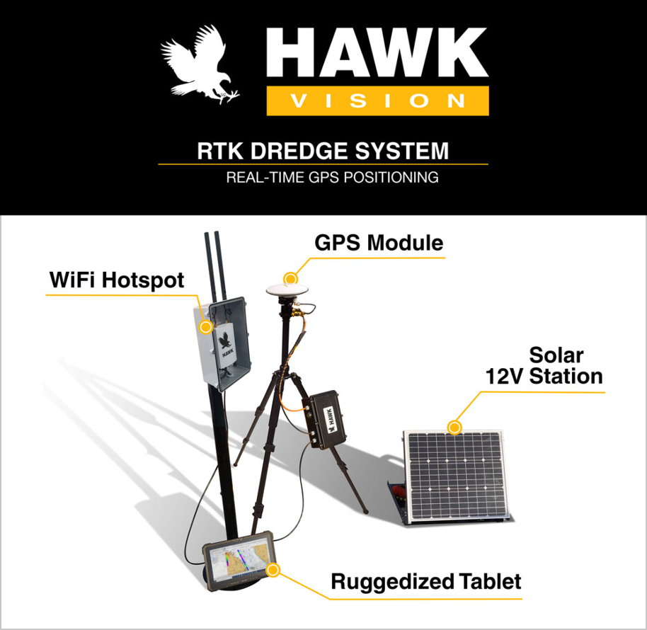
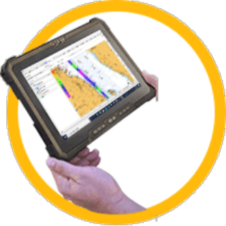
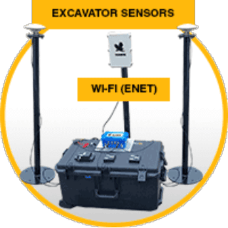
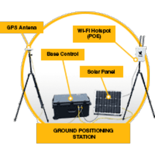
The Hawk Vision RTK GPS System combines cutting-edge technology and advanced algorithms to deliver exceptional performance. It works by receiving signals from multiple satellites and a nearby base station. It employs a GPS RTK module and boom sensor on the excavator, along with a base control station for precise positioning. The base station provides correction data that helps eliminate errors caused by atmospheric conditions and other factors. The RTK GPS receiver then uses this corrected data to calculate its precise position in real-time with centimeter-level accuracy. This integrated system allows for real-time GPS data acquisition, ensuring accuracy and efficiency in excavation operations.
How much does an RTK GPS system cost?
The cost of an RTK GPS system can vary depending on factors such as the brand, features, and system configuration. Generally, RTK GPS systems range in price from a few thousand dollars to tens of thousands of dollars. It is recommended to contact the Hawk Excavator Expert team, for accurate pricing information and to discuss your specific requirements.
What is the advantage of Hawk RTK GPS System?
The Hawk RTK GPS system offers several advantages. It provides highly accurate positioning, which is crucial for tasks requiring precision, such as surveying and construction layout. The system allows for faster data collection and reduces the need for manual measurements. It improves efficiency, productivity, and ultimately helps save time and resources.
Can the Hawk RTK GPS system be used in challenging environments?
Yes, the Hawk RTK GPS system is designed to perform well even in challenging environments. It utilizes advanced signal processing techniques to mitigate multipath errors and interference, ensuring reliable and accurate positioning in difficult conditions such as urban areas or areas with dense foliage.
Is the Hawk RTK GPS system compatible with other equipment and software?
Yes, the Hawk RTK GPS system is designed to be compatible with a wide range of equipment and software commonly used in the industry. It can integrate with surveying instruments, machine control systems, GIS software, and other third-party applications, allowing seamless data transfer and interoperability.
How can I integrate the Hawk RTK GPS system into my existing workflow?
Integrating the Hawk RTK GPS system into your existing workflow is typically straightforward. Our system provides flexible data output options, including industry-standard formats like NMEA and RINEX. This allows for easy integration with your preferred software or equipment, enabling you to seamlessly incorporate high-precision positioning into your workflow.

Reviews
There are no reviews yet.